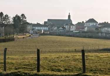
Tour Wandern Tourouvre au Perche - Bubertrté - Photo
 DranoelNiala
DranoelNiala

Benutzer

© OpenStreetMap contributors
Länge
Länge
7,8 km
Maximale Höhe
Maximale Höhe
323 m
Positive Höhendifferenz
119 m
Km-Effort
Km-Effort  
9,4 km
Min. Höhe
Min. Höhe
260 m
Negative Höhendifferenz
117 m
Boucle
Boucle
Ja
Erstellungsdatum :
2023-07-17 14:46:22.87
Letzte Änderung :
2023-08-26 13:32:33.508

(0 Nachricht)

Wandern
Wandern
2h08
Schwierigkeit : Medium

Scannen Sie diesen QR-Code, um die Tour in der SityTrail-Anwendung zu öffnen

Kostenlosegpshiking-Anwendung

Logo SityTrail SityTrail

IGN / Geografische Institute

SityTrail aus dem App Store herunterladen SityTrail von Google Play herunterladen

Logo SityTrail SityTrail World

Die Welt öffnet sich für Sie

SityTrail aus dem App Store herunterladen SityTrail von Google Play herunterladen SityTrail auf Huawei AppGallery herunterladen

Über SityTrail

Tour Wandern von 7,8 km verfügbar auf Normandie, Orne, Tourouvre au Perche. Diese Tour wird von DranoelNiala vorgeschlagen.

Beschreibung

Boucle autour de Bubertré en grande partie dans la,forêt. Idéale par temps chaud !

Höhenprofil

Ort

Land:
France
Region :
Normandie
Abteilung/Provinz :
Orne
Kommune :
Tourouvre au Perche
Standort:
Bubertré
Gehen Sie:(UTM)
323042 ; 5385308 (31U) N.

Touren in der Umgebung

Tour Wandern Tourouvre au Perche - [Itinéraire] Parcours de découverte de la Réserve de Bresolettes - Photo
Wandern
ODDAD78

Wandern

Einfach
Tourouvre au Perche, Normandie, Orne, France
4,2 km | 4,8 km-effort
1h 5min
Ja
Tour Wandern Soligny-la-Trappe - Soligny-la-Trappe - Tourouvre - voie Nord 14 km - Photo
Wandern

Wandern

Einfach
Soligny-la-Trappe, Normandie, Orne, France
13,8 km | 16,6 km-effort
3h 40min
Nein
Tour Wandern Soligny-la-Trappe - Soligny-la-Trappe - Tourouvre - voie Sud 11 Km - Photo
Wandern

Wandern

Einfach
Soligny-la-Trappe, Normandie, Orne, France
11,1 km | 13,5 km-effort
20min
Nein
Tour Wandern Tourouvre au Perche - Bubertré - Lignerolles (Boucle) - Photo
Wandern
neitag61

Wandern

Einfach
(1)
Tourouvre au Perche, Normandie, Orne, France
12,3 km | 15,2 km-effort
3h 0min
Ja
Tour Mountainbike Tourouvre au Perche - [Itinéraire] Les ruines du château de Gannes - Photo
Mountainbike
ODDAD78

Mountainbike

Schwierig
Tourouvre au Perche, Normandie, Orne, France
28 km | 34 km-effort
2h 20min
Ja
Tour Auto Tourouvre au Perche - 2024-02-24 Perche Trappe V du  - Photo
Auto
patrick2m

Auto

Tourouvre au Perche, Normandie, Orne, France
38 km | 45 km-effort
4h 15min
Nein
Tour Mountainbike Tourouvre au Perche - 2023-12-2 vduP perche-trappe  - Photo
Mountainbike
patrick2m

Mountainbike

Medium
Tourouvre au Perche, Normandie, Orne, France
22 km | 24 km-effort
3h 46min
Nein
Tour Wandern Tourouvre au Perche - 2023-10-26 Trappe  - Photo
Wandern
patrick2m

Wandern

Medium
Tourouvre au Perche, Normandie, Orne, France
6,9 km | 7,6 km-effort
2h 2min
Nein
Tour Wandern Tourouvre au Perche - [Itinéraire] L'étang du Cachot - Photo
Wandern
ODDAD78

Wandern

Medium
Tourouvre au Perche, Normandie, Orne, France
6 km | 7,3 km-effort
1h 39min
Ja


Schließen
Meine Abonnements